From Roger's web site: "This software is a tool used to predict the performance of a radio system. It uses digital terrain elevation data for automatic extraction of path profile between an emitter and a receiver. This data is added to system, environmental and statistical parameters to feed the Irregular Terrain Model radio propagation model. Elevation data is also used to produce virtual maps in background."
This program predicts performance by taking into account transmit power, receiver sensitivity, antenna gain and patterns, coax and other losses, antenna height, operating frequency, curvature of the earth, ground characteristics (conductivity, ...) and ground terrain (elevation). The trickiest part of this prediction is the elevation profile between transmitter and receiver. Fortunately this data is freely available on the internet from several sources. The data I used is from NASA's Shuttle Radar Topography Mission (SRTM). This data has 1 arcsecond (30 meters) resolution, with elevation resolved to 1 meter. Each file covers a 1-degree square of latitude and longitude. To cover the state of Ohio required nearly 500 MB of downloaded data.
The coverage maps that are produced do not take into account buildings, trees, local interference and noise. Here are some predictions based on typical mobile, handheld, and base station performance characteristics. If you look closely (load the full-size map into your favorite image editing program and enlarge or magnify it) you will be able to see very fine details of the topography. Especially at the fringes, it will be obvious where the hills (with signal) and valleys (no signal) are located.

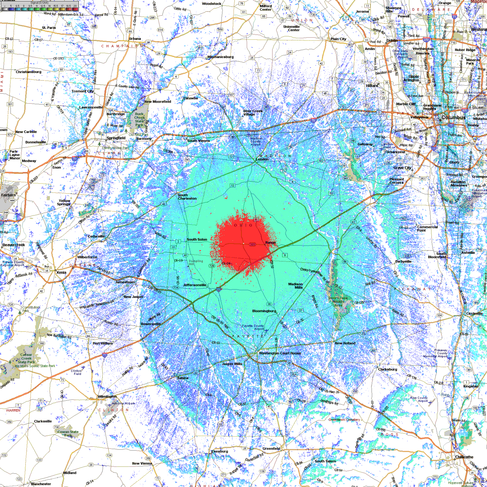
The RED area represents the strongest signal area, the DARK BLUE represents a weak but usable signal.

The RED area represents the strongest signal area, the DARK BLUE represents a weak but usable signal.

The RED area represents the strongest signal area, the DARK BLUE represents a weak but usable signal.

The RED area represents where a low-powered handheld should have no trouble getting into the system. Mobiles should have no trouble from the GREEN or BLUE areas.

The RED area represents where a low-powered handheld should have no trouble getting into the system. Mobiles should have no trouble from the GREEN or BLUE areas.

The RED area represents where a low-powered handheld should have no trouble getting into the system. Mobiles should have no trouble from the GREEN or BLUE areas.
The RED area represents where a low-powered handheld should have no trouble getting into the system. Mobiles should have no trouble from the GREEN or BLUE areas.

The RED area represents where a low-powered handheld should have no trouble getting into the system. Mobiles should have no trouble from the GREEN or BLUE areas.